


Unit outcomes
Pupils who are secure will be able to:
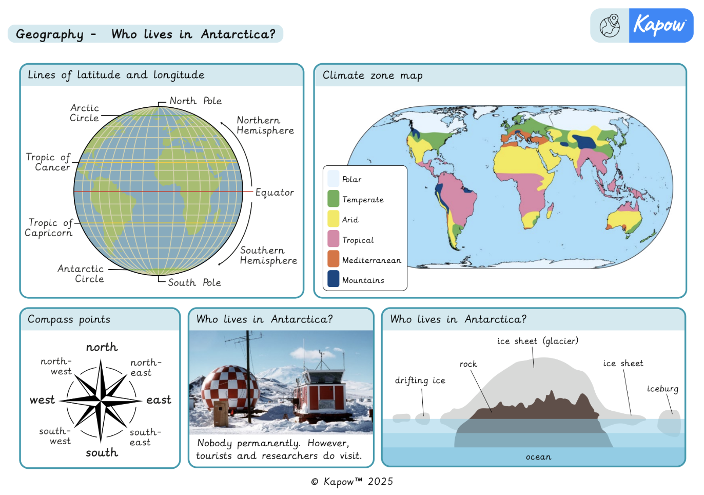
- Describe lines of latitude and longitude, giving an example.
- Understand that the Northern and Southern Hemispheres have seasons at different times.
- Define climate zones, giving an example.
- Describe Antarctica’s position in the far south and its polar climate of ice sheets, snow and mountains.
- Describe tourism and research as the main reasons people visit Antarctica and list examples of research done there.
- Describe the equipment and clothing researchers use in Antarctica.
- State the outcome of Shackleton’s expedition.
- Plot four figure grid references where the vertical and horizontal lines meet and begin to recall the eight points of a compass, following at least four of them.
- Use the zoom function on a digital map and recognise and describe features of the school grounds from an aerial map.
- Describe a similarity and a difference between life in the UK and life in Antarctica.
- Draw a map of the route taken on an expedition.
- State one thing that went well on the expedition and one aspect that did not go as hoped.
Lesson 6 involves fieldwork on the school grounds. It is important to risk-assess the proposed route taking into account any relevant school risk assessment policies and procedures. Refer to the Before the lesson section in Lesson 6 to prepare for this lesson. Please be aware this lesson may take longer than 1 hour.
Lesson 5 requires a device (one per pair).
Suggested prior learning
Y3/4 (A): Where does our food come from?
Get startedLessons
Y3/4 (B): Lesson 1: What is climate?
Y3/4 (B): Lesson 2: Where is Antarctica?
Y3/4 (B): Lesson 3: Who lives in Antarctica?
Y3/4 (B): Lesson 4: Who was Shackleton?
Y3/4 (B): Lesson 5: Can we plan an expedition around school?
Y3/4 (B): Lesson 6: How did our expedition go?
Key skills
- Locating some

This content is for subscribers only. Join for access today.
Key knowledge
- To know
This content is for subscribers only. Join for access today.
Key vocabulary
climate
climate zone
This content is for subscribers only. Join for access today.
Related content
Unit resources

Knowledge organiser: Geography – Y3 Who lives in Antarctica?
Aimed at pupils, two pages providing key facts and definitions from the unit "Who lives in the Antarctic?".
Vocabulary display – Geography Y3: Who lives in Antarctica?
A display version of the vocabulary from the unit ‘Who lives in Antarctica?’.
Subject resources
This content is for subscribers only. Join for access today.
Cross-curricular opportunities
Science: States of matter
Mathematics: Geometry – position and direction
English: Spoken language
British values: Rule of law
Build on the learning
Y3/4 (B): Are all settlements the same?
Get startedPopular content
- Geography: Curriculum portal
- Geography: Curriculum information
- Geography subject leader hub
- Geography: Fieldwork guide
- Geography: Staff Presentation
- Webinar: An introduction to geography
- Geography: Progression of concepts —mixed-age
- Ace your role as a D&T subject leader
- Ace Your Role As A Music Subject Leader