


- Subjects >
- Computing >
- Key stage 2 >
- Year 4 >
Unit outcomes
Pupils who are secure will be able to:
- Search the web efficiently to find temperatures of different cities and record this accurately.
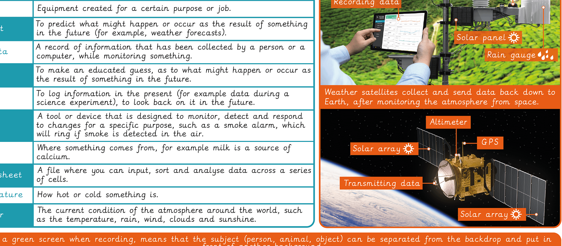
- Design a weather station that gathers and records sensor data, explaining how it works and the units of measurement it would use.
- Design an automated machine that uses selection to respond to sensor data.
- Search for and record weather forecast information in a spreadsheet and explain how this data is collected.
- Create a video which includes weather forecast information.
Suggested prior learning
Data handling: Comparison cards databases
Get startedLessons
Lesson 1: What is the weather?
Lesson 2: Weather stations
Lesson 3: Extreme weather
Lesson 4: Satellites and forecasts
Lesson 5: Presenting forecasts
Key skills
- Using tablets or digital

This content is for subscribers only. Join for access today.
Key knowledge
- To know that computers
This content is for subscribers only. Join for access today.
Key vocabulary
accurate
climate zone
This content is for subscribers only. Join for access today.
Related content
Unit resources

Knowledge organiser – Computing Y4: Investigating weather
Aimed at pupils, a single page which gives key facts and definitions from the unit.
Vocabulary display – Computing Y4: Data handling: Investigating weather
A display version of the key vocabulary from the Data handling: Investigating weather unit.
Subject resources
This content is for subscribers only. Join for access today.
Cross-curricular opportunities
Science – temperature, eveporation and condensation, water cycle, observations and accurate measurements.
Geography – physical geography including climate zones, biomes, vegetation belts, rivers, mountains, volcanoes and earthquakes. Maps, atlases, globes and digital/computer mapping. Counties and cities of the United Kingdom.
Maths – bar charts, pictograms, tables and other graphs.
English: Spoken Language – discussions, presentations, performances, role play, improvisations and debates.