


Geography curriculum
This page is designed for Geography subject leaders to:
- View the Kapow Primary Geography curriculum in one convenient place.
- Discover the rationale behind Kapow Primary’s Geography curriculum.
- Find relevant information to support leading Geography.
The Curriculum and Assessment Review final report has been released. We’re reviewing the recommendations and planning for future updates.
For more information, see our Curriculum updates and FAQs pages.
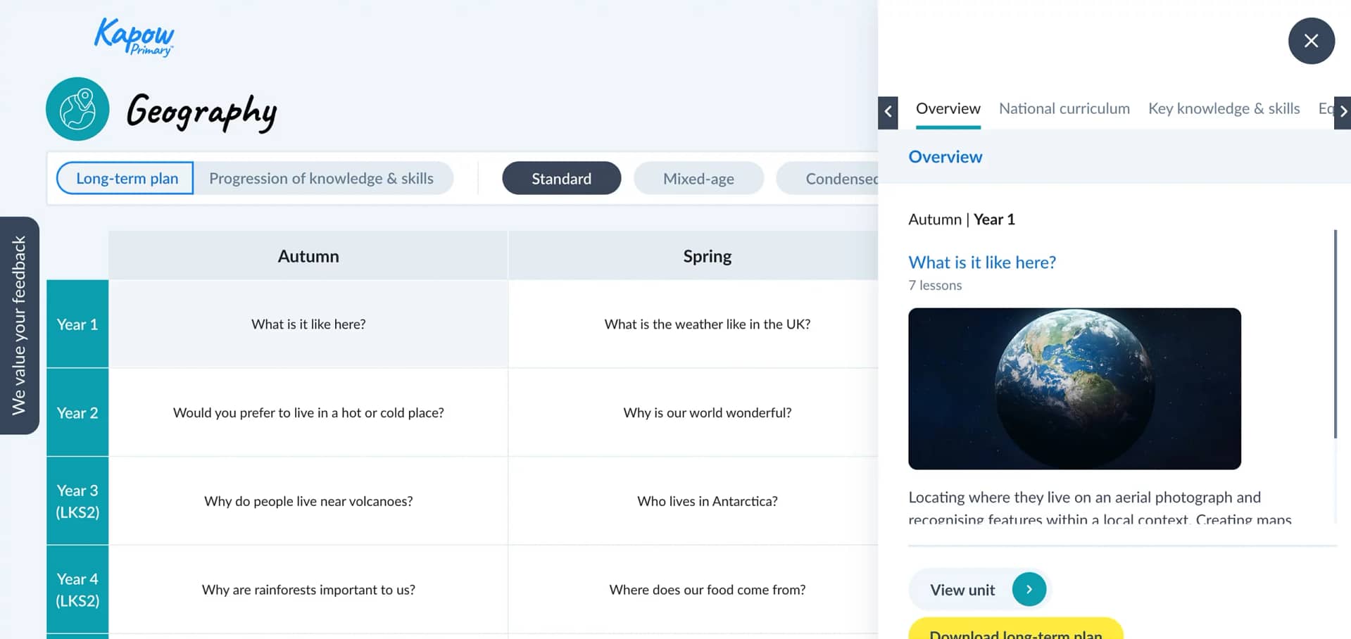
Geography scheme of work
Contains public sector information licensed under the Open Government Licence v2.0
1. Intent
This section outlines the overall curriculum plan, including its structure, sequencing and the specific knowledge and skills students are expected to acquire.
Curriculum aims
Kapow Primary’s Geography scheme of work aims to inspire pupils to become curious and explorative thinkers with a diverse knowledge of the world – in other words, to think like geographers. The intention is for pupils to develop the confidence to question and observe places, measure and record necessary data in a variety of ways and analyse and present their findings.
The scheme aims to build an awareness of how Geography shapes lives at multiple scales and over time. The hope is to encourage pupils to become resourceful, active citizens who will have the skills to contribute to and improve the world around them.
The scheme supports teachers in developing their subject knowledge and skills, enabling the delivery of engaging, well-informed lessons with confidence. The curriculum is designed to be both accessible and ambitious, ensuring all learners’ full participation and potential achievement.

Statutory and non-statutory guidance
National curriculum
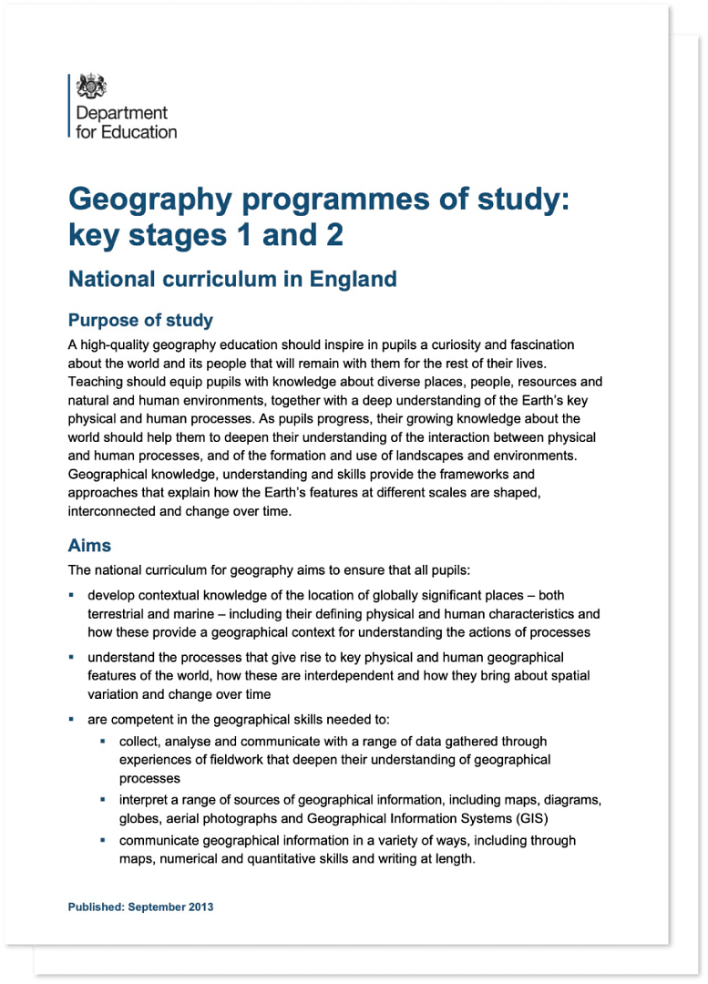
Our standard, mixed-age and condensed schemes of work fulfil the statutory requirements for Geography outlined in the National curriculum (2014).
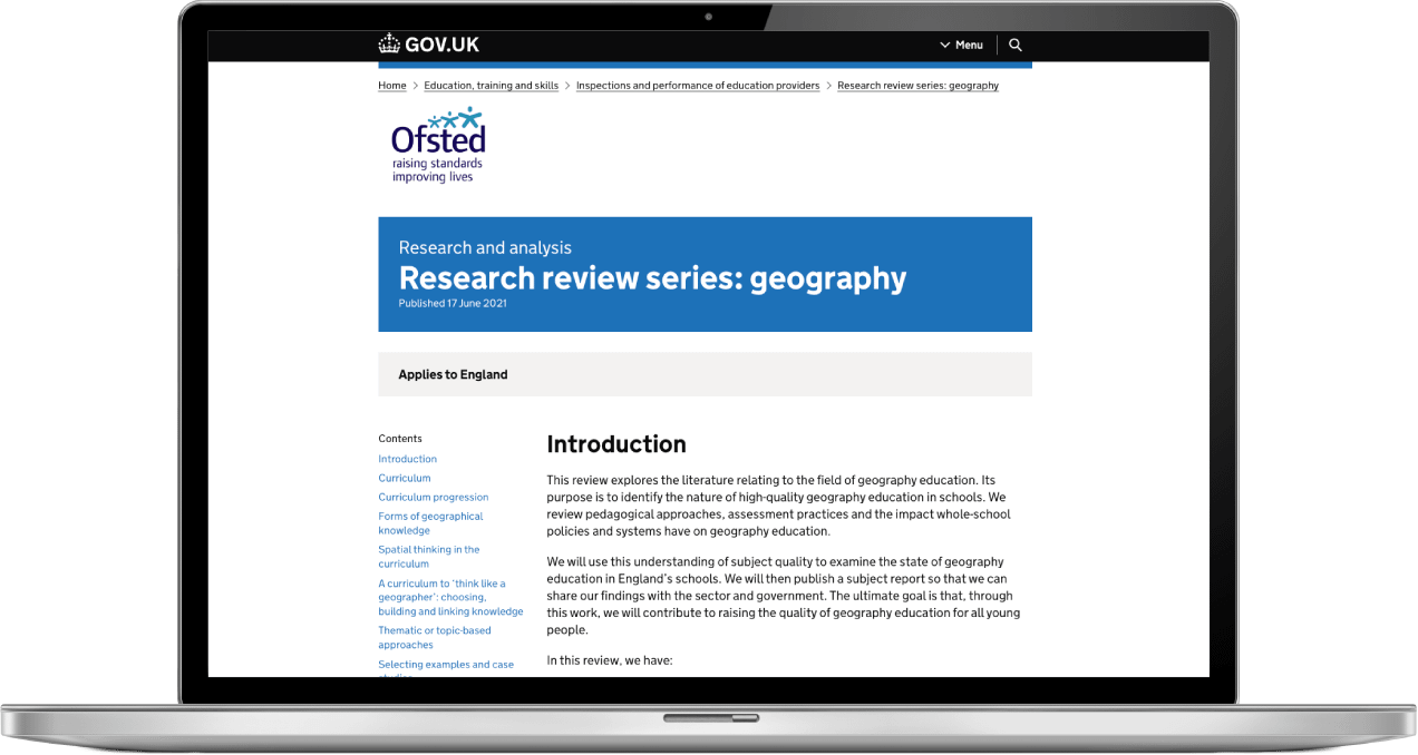
Ofsted research review
Kapow Primary’s standard, and mixed-age Geography schemes of work are based on principles outlined in Ofsted’s Geography research review.
New research and developments
The standard and mixed-age schemes of work are continually evaluated and refined through regular curriculum reviews, internal audits and feedback from subscribing schools.
Updates are informed by the latest subject-specific research, changes to National curriculum guidance and developments in pedagogy. This ensures the curriculum remains current, effective and relevant.

Broad and balanced curriculum
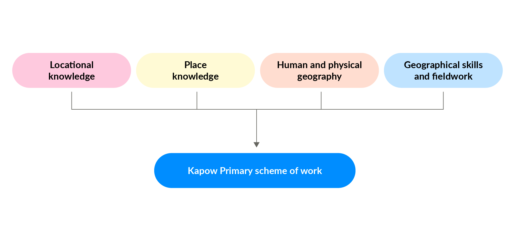
The four strands
The National curriculum organises the attainment targets for Geography under:
- Locational knowledge.
- Place knowledge.
- Human and physical geography.
- Geographical skills and fieldwork.
Kapow Primary’s Geography curriculum has been planned with these strands running through each unit, ensuring balanced coverage of the different areas of Geography and both substantive and disciplinary knowledge.
Locational knowledge
Developing pupils' sense of place and identity; developing an appreciation of distance and scale; and learning about the orientation of the world.
Place knowledge
Locating physical areas on maps and attaching meaning to these spaces so they becomes ‘places’.
Human and physical geography
Describing and explaining different environments and their formation.
Geographical skills and fieldwork
Interpreting spacial representations including maps, globes and atlases to develop a sense of place.
Progression
Progression of skills and knowledge
The Geography: Progression of skills and knowledge document provides an overview of the skills and knowledge covered in each phase and strand. It explains how Geography skills and knowledge are developed to support pupils in reaching the key stage outcomes as outlined in the National curriculum.
New learning is weighted toward the start of each key stage, allowing ample opportunity for it to be revisited and applied in later years. As a result, knowledge accumulation may look heavier in some year groups than others.

Progression of vocabulary
Kapow’s progression of vocabulary for Geography focuses on the essential words and terms for understanding the subject. These words are carefully selected to help pupils grasp concepts and ideas outlined in the Kapow Primary Geography curriculum.
Geography vocabulary is categorised under four curriculum strands: Locational knowledge, Place knowledge, Human and physical geography and Geographical skills and fieldwork.
Locational knowledge is split into further sub-strands. In alignment with the National curriculum’s aim for pupils to ‘develop contextual knowledge of the location of globally significant places’, specific locations are selected that correspond with the contexts and themes explored in the Kapow Primary Geography units.

Spiral curriculum
Kapow Primary’s Geography scheme has been designed as a spiral curriculum with the following key principles in mind:
- Cyclical – pupils return to the key knowledge and skills again and again during their time in primary school.
- Increasing depth – each time a skill is revisited, it is covered with greater complexity.
- Prior knowledge – pupils build upon previous foundations rather than starting again.

Broadening horizons
The process of broadening horizons involves starting with familiar contexts, such as the pupils’ local area, then gradually expanding to more distant or global perspectives. This approach helps learners build on their existing knowledge and understand their place in the wider world.
Types of knowledge
Types of knowledge
Knowledge is defined differently depending on the subject in question. Ofsted’s Geography research review helps to define these Geography knowledge strands as:
- Disciplinary knowledge.
- Substantive knowledge.
- Procedural knowledge.

Disciplinary knowledge
Ways of knowing
Pupils gain knowledge of the subject as a discipline, considering how geographical knowledge (such as the substantive knowledge they study) originates through geographical practice.
Substantive knowledge
Knowing about
Substantive knowledge is the content that pupils will learn through studying the Geography curriculum: the recognised knowledge of the world and the human and physical processes that affect the people and environments within it.

Procedural knowledge
Knowing how to
Pupils gain procedural knowledge primarily through the Geographical skills and fieldwork strand.

Wider knowledge and skills
Digital literacy
Kapow Primary’s Geography scheme integrates technology through digital maps, research tasks and interactive activities. This helps develop the children’s ability to find, evaluate and use geographical information effectively.

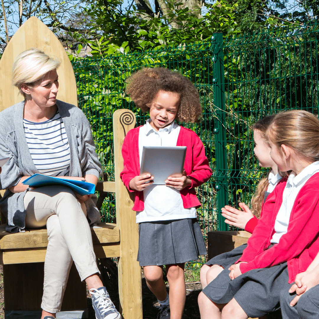
Oracy
Lessons encourage discussion, debate, and presentations on geographical topics, allowing the children to articulate their understanding, justify opinions and engage in collaborative learning.
The children will use oracy to enhance their learning by thinking aloud, questioning and discussing activities. They will develop essential skills such as choosing appropriate vocabulary, organising their ideas and listening effectively.
Sustainability
The Geography curriculum promotes awareness of environmental issues, encouraging children to develop a sense of responsibility for the planet by exploring concepts such as climate change, resource use, and conservation.
The significance of climate change is crucial for understanding geographical interconnections. As stated by the Department for Education’s 2023 guidance, Sustainability and climate change strategy educating children on the planet’s evolving conditions is vital. The guidance encourages all schools to enact a climate action plan and foster sustainable learning environments.
Engaging pupils with environmental issues can spark enthusiasm for positive change, broaden their understanding of sustainability, alleviate climate-related anxieties and instil pride in their educational settings.

Critical thinking
Pupils analyse geographical data, compare different perspectives and evaluate sources of information. This helps them in questioning assumptions and forming reasoned conclusions on global and local issues.

Personal development in Geography
SMSC
The scheme supports SMSC (Spiritual, Moral, Social and Cultural) development by encouraging children to:
- Explore different perspectives.
- Reflect on ethical issues.
- Collaborate with others.
- Appreciate cultural diversity through subject-specific content.

British values
Lessons promote British values (democracy, the rule of law, individual liberty, mutual respect and tolerance) by incorporating activities that encourage debate, respect for differing opinions and an understanding of societal structures.

Cultural capital
Kapow Primary’s Geography curriculum broadens children’s experiences by introducing them to key figures, historical and geographical contexts and diverse traditions. It ensures they gain the knowledge and skills needed to engage meaningfully in society.
Transition from EYFS to KS1
Continuity of learning
Kapow Primary’s Geography scheme aligns with the statutory EYFS guidance.
Key themes and skills introduced in EYFS are revisited and developed further in Key stage 1, ensuring continuity and progression.
This transition is aided by the continuity of learning created by the curriculum strands, which run from EYFS to Year 6. Subject leaders can pinpoint how knowledge develops in Reception and how this creates the foundation for learning in Key stage 1.

Building on early experiences
Lessons build on curiosity, exploration and discussion, which are central to EYFS learning. As pupils move into Year 1, more structured activities are gradually introduced.
In Key stage 1, oracy, questioning and storytelling help children transition from informal to more formal subject-based learning.

Development of key skills
The scheme supports the progressive development of skills, such as observation, reasoning and problem-solving, which are introduced in EYFS and strengthened in Key stage 1.
Adaptive teaching strategies ensure all learners are supported as they transition to more formal learning approaches.

Cross-curricular links
The scheme connects with EYFS Early Learning Goals, making links with communication and language, understanding the world and expressive arts to create a seamless transition.
It fosters independence and confidence, supporting children as they adapt to the expectations of Key stage 1 learning.

Inclusion and diversity
Inclusion and diversity
Kapow Primary’s Geography scheme has been designed to represent a range of cultures and races.
- Where appropriate, colonial choices and their impact on geographical issues are explored.
- The scheme’s visual representation is inclusive and representative of a variety of people and places, challenging stereotypes or historical ideologies.
- Within sensitive units, questions have been included to support children’s lived experiences and backgrounds.
- Resources and case studies are carefully considered to encourage the children to think about their role in society and to respect the many ways in which people’s lives have been influenced.
The scheme supports children in appreciating the complexity of people’s lives, the diversity of societies and the relationships between different groups.

2. Implementation
This section outlines how the curriculum is taught in the classroom – including teaching strategies, learning activities and the use of resources. It also includes details on how the curriculum can be adapted to suit your school and cohort.
Timetabling
Kapow Primary’s Geography scheme is designed to be taught for one hour per week, alternating with History every half-term. This approach is based on market research, which showed that most schools structure their curriculum this way.
Timetabling Geography in this way ensures the needs of the National curriculum are met.

CPD
Kapow Primary supports teachers in delivering the Geography curriculum effectively through clear and informative CPD videos. These videos are designed to help teachers feel confident in their role by providing guidance on key concepts, teaching strategies and best practices.

With Kapow Primary’s CPD videos, subject leaders can develop their expertise and, in turn, support their colleagues in delivering high-quality lessons.
Whether helping with subject knowledge, modelling effective teaching techniques or offering practical tips for the classroom, Kapow’s CPD videos ensure that every teacher has access to the support they need.

Preparing for lessons - Before the lesson
Watch
View teacher CPD videos and pupil videos in one place. The videos relate directly to the teaching and learning in the lesson or unit.
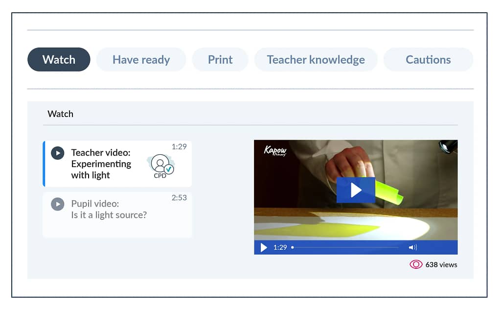 For illustrative purposes only – the exact ‘Before the lesson’ sections vary between lessons.
Have ready
Prepare for each lesson using a list of the suggested presentations, materials, items or links.
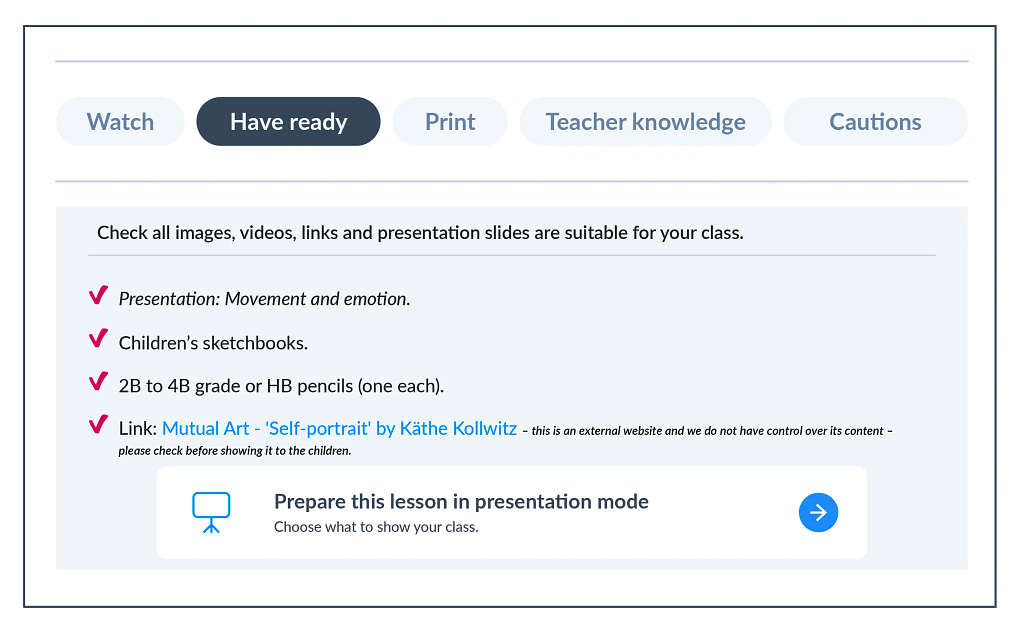 For illustrative purposes only – the exact ‘Before the lesson’ sections vary between lessons.
Printable resources for each lesson are grouped in this section so they can be located easily. Resources are also clearly stated at the point of use in each lesson plan.
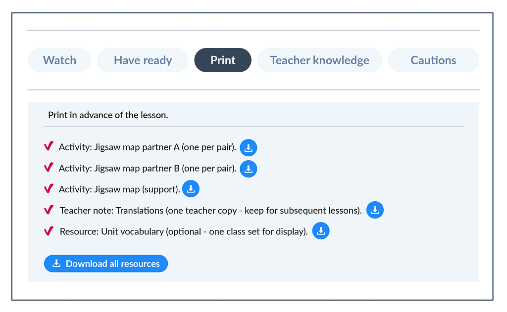 For illustrative purposes only – the exact ‘Before the lesson’ sections vary between lessons.
Teacher knowledge
View teacher knowledge at a glance relevant to the particular lesson. This includes tips on lesson organisation, common misconceptions and additional subject knowledge to help teach tricky concepts with confidence.
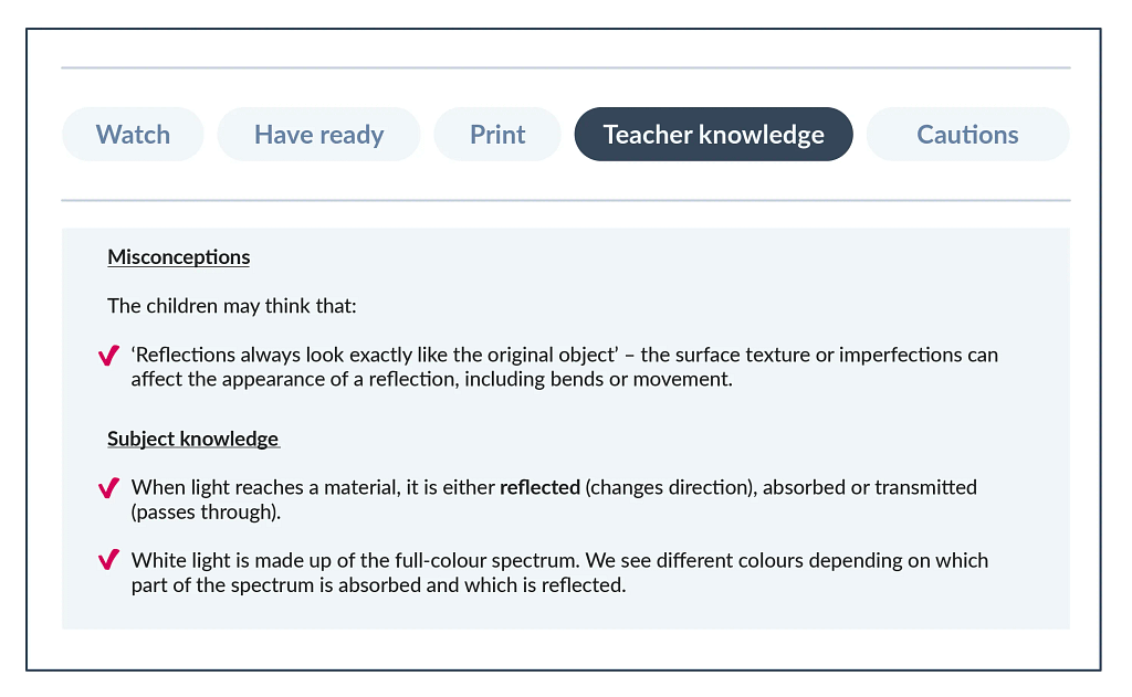 For illustrative purposes only – the exact ‘Before the lesson’ sections vary between lessons.
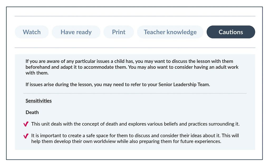
Cautions
This section highlights parts of the lesson that may need careful handling or may be relevant for a particular cohort. Background information and suggested guidance are provided to help navigate lessons with potentially sensitive topics.
 For illustrative purposes only – the exact ‘Before the lesson’ sections vary between lessons.
Unit structure
Unit hubs
Geography unit hubs contain all the necessary lesson links, resources and information relevant to the unit being taught.
Information on the unit hubs corresponds to all the relevant Geography key documents, such as the Progression of skills and knowledge and vocabulary progression.
The unit hub also links to useful resources and key documents, suggests units that could build on knowledge or activate prior learning and outlines cross-curricular links.

Unit hubs offer a wealth of useful information such as useful updates; major planning considerations like fieldwork; key skills and knowledge; and much more.
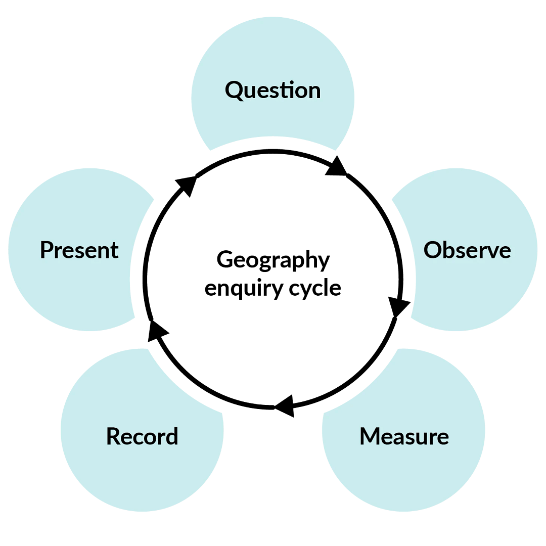
The enquiry cycle
It is important that pupils begin to ‘think like geographers’ by considering the ways that geographers question and explain the world.
Accordingly, the Kapow Primary Geography scheme uses an enquiry cycle to support planning fieldwork. This encourages pupils to ask geographical questions and learn how geographers reach their answers through enquiry.
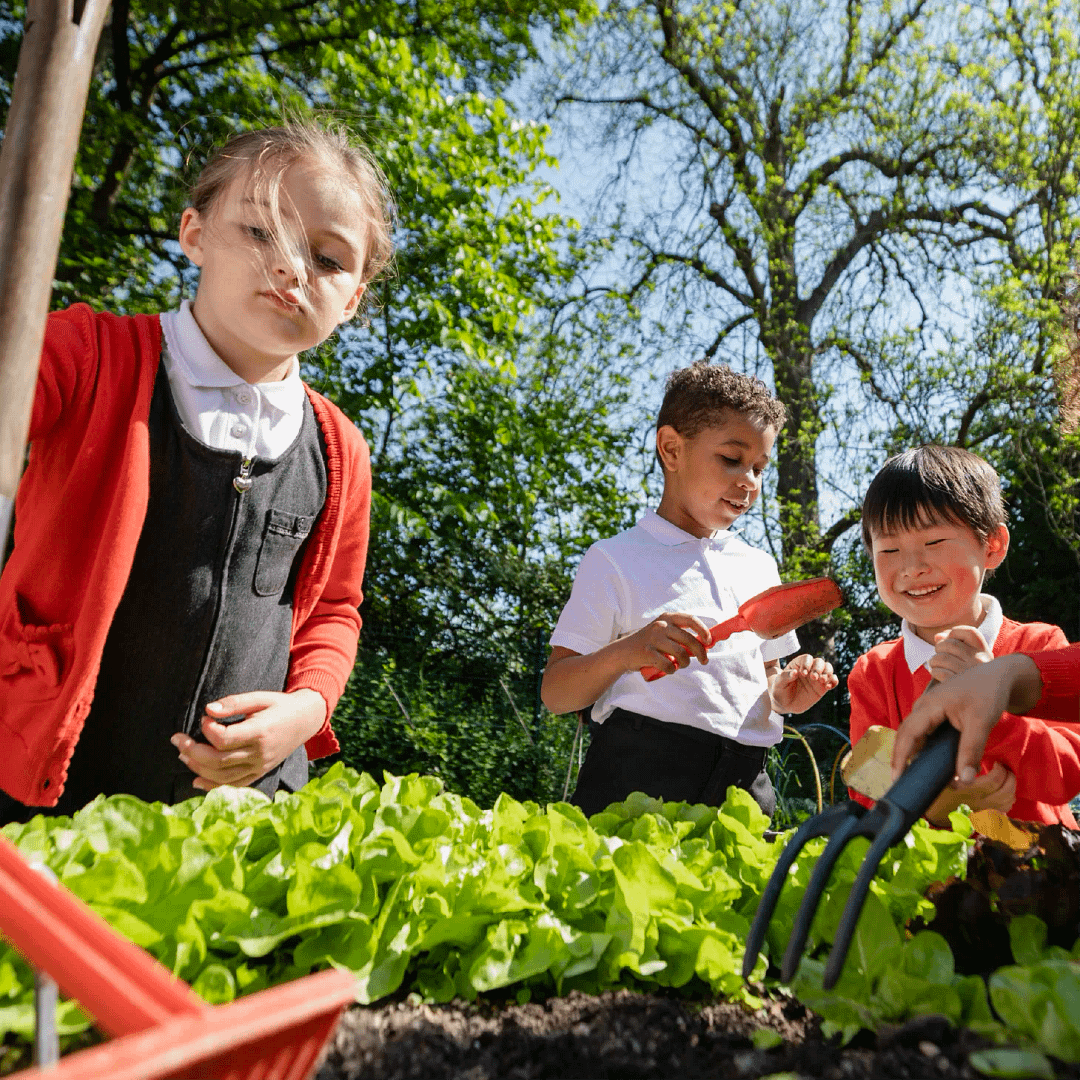
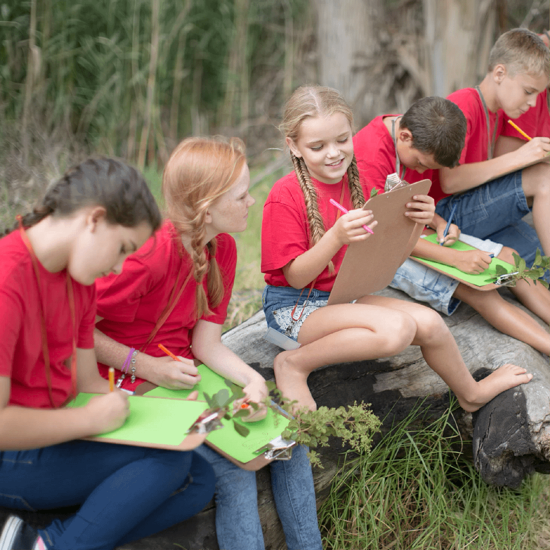
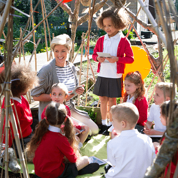
Fieldwork
Fieldwork provides children with hands-on experience and encourages them to apply geographical concepts to their surroundings.
Fieldwork skills do not have to be developed on school trips alone: local fieldwork opportunities can make the subject matter relevant and support teachers in fostering a sense of community and environmental awareness amongst pupils.
Fieldwork on the school grounds and the local area is an important element of the Kapow Primary Geography scheme: it is often more practical, engaging and meaningful for pupils.
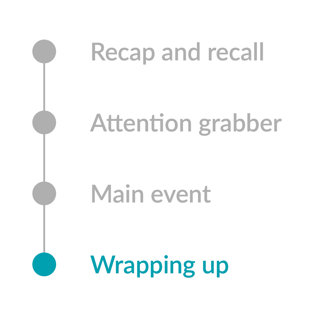
Lesson structure
Recap and recall
Each lesson begins with a short activity revisiting prior learning. This helps reinforce key knowledge, activate long-term memory and create connections between past and new learning.
Recap and recall activities are varied to keep the start of the lesson engaging and fun while still supporting active recall.
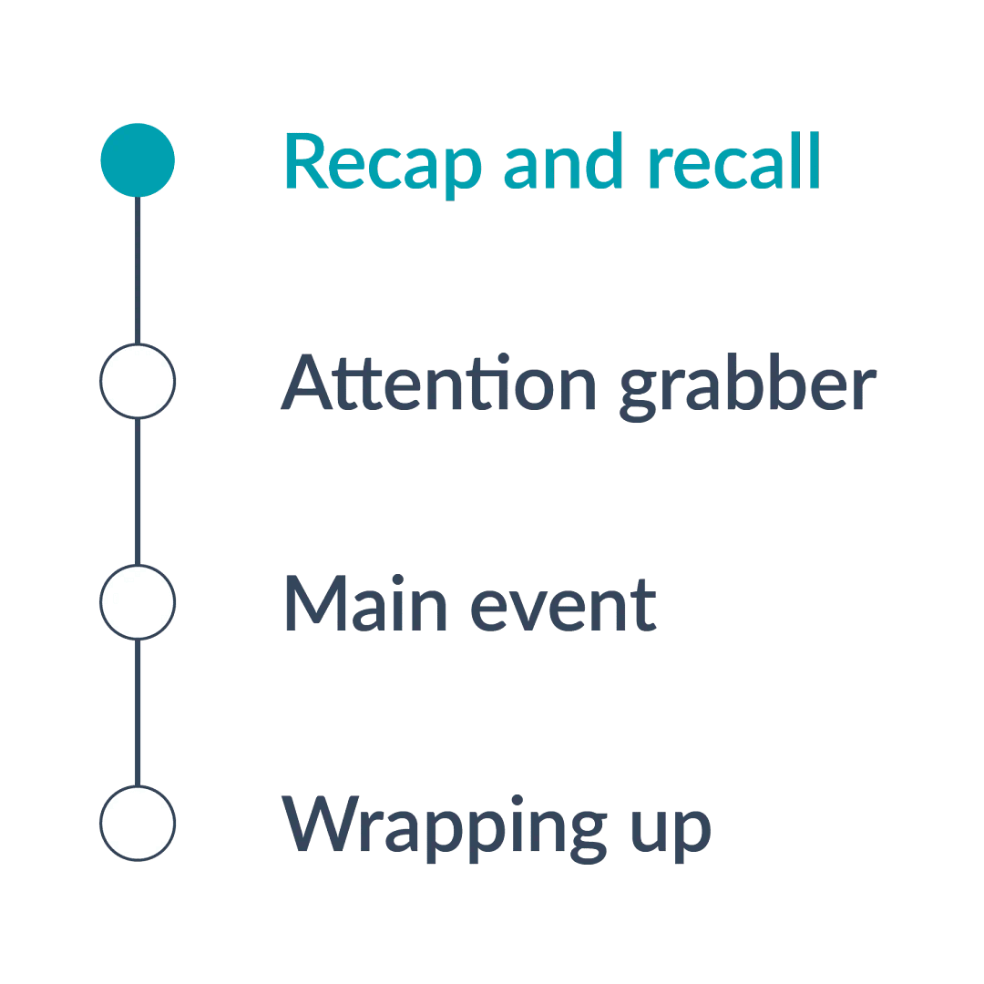
Attention grabber
A short, engaging activity designed to hook pupils into the new learning in the lesson.
This could be a thought-provoking question, a quick investigation or an interactive discussion to spark curiosity and enthusiasm for the topic.

Main event
The core part of the lesson, where children engage in activities that develop their understanding of the learning objective.
This includes a mixture of teacher modelling, guided practice and independent or collaborative tasks tailored to support all learners.

Wrapping up
A final reflective activity that consolidates learning.
This could involve reviewing the success criteria, discussing key learning or applying knowledge in a different context to assess understanding and encourage deeper thinking.
SEND
The Kapow Primary Geography scheme of work is designed to be fully adaptable for pupils with SEND. Every lesson includes an adaptive teaching section, providing clear guidance on how activities can be modified to meet the needs of all learners.
Children learn in a variety of ways. As such, Kapow Primary geography lessons include a range of strategies to support and challenge every pupil, such as:
Scaffolding – activities are designed with flexibility in mind, allowing for additional support or challenge where needed.
Multi-sensory approaches – lessons incorporate different elements to engage all learners.
Clear instructions and structured tasks – ensuring clarity and reducing cognitive load for pupils who benefit from additional support.
Opportunities for collaborative and independent learning – allowing pupils to work at their own pace while building confidence and independence.
By embedding adaptive teaching throughout, the scheme ensures that all pupils, regardless of their starting points, can access and succeed in their learning.
In addition, the step-by-step curriculum design supports pupils with SEND, avoiding sudden jumps in complexity at transition points and allowing for steady, manageable progression.
Knowledge retention
Spiral curriculum
Kapow Primary’s Geography scheme incorporates a spiral curriculum model, ensuring that children revisit and develop their understanding of key themes and concepts as they progress. This approach allows them to make meaningful connections, reinforce their learning and achieve mastery over time.
- Revisiting key concepts – pupils encounter the same ideas multiple times throughout their education, with each revisit adding more complexity.
- Progressive depth – concepts are not just repeated but expanded upon, helping pupils to make connections and develop a richer understanding over time.
- Knowledge retention – regular exposure to key ideas strengthens memory and prevents knowledge from being forgotten.
- Skill development – pupils refine and apply their skills in different contexts, improving their ability to think critically and solve problems.
- Adaptive learning – by building on prior knowledge, the curriculum meets pupils at their current level and supports all learners, including those who need extra reinforcement and those who are ready for greater challenges.

Knowledge organisers
Kapow Primary’s Knowledge organisers are a structured document designed to support pupils’ learning by clearly outlining the key knowledge, vocabulary and concepts covered in a unit of work.
It serves as a reference tool for both teachers and pupils, helping to consolidate learning and support knowledge retention.
- Essential knowledge at a glance – summarises the most important facts, concepts and skills that pupils need to learn for a particular unit.
- Key vocabulary – provides a list of subject-specific terms with definitions to develop pupils’ language and understanding.
- Clear and visual layout – organised in a way that makes information easy to digest and revisit, often using diagrams, timelines or key images.
- Support for retrieval practice – helps pupils engage in self-assessment, recall activities and revision, reinforcing long-term memory.
- Teacher and pupil-friendly – acts as a quick reference for teachers when planning lessons and an accessible learning aid for pupils to develop independence in their studies.
Recap and recall
- Activates prior knowledge – helps pupils make connections between new and existing learning, reducing cognitive overload.
- Strengthens memory pathways – retrieval practice has been shown to improve retention more effectively than passive review.
- Identifies gaps in understanding – teachers can quickly assess what children remember and address misconceptions before introducing new content.
- Builds confidence – regular recall activities reassure pupils that they can remember key concepts, improving engagement and motivation.
- Promotes spaced learning – revisiting prior learning at regular intervals supports long-term retention, rather than cramming information in a single lesson.

Additional adults
Support for additional adults
Kapow Primary recognises that teaching assistants play a vital role in many classrooms and that in some schools, they may be responsible for delivering lessons.
Accordingly, anyone teaching Kapow Primary’s Geography lessons can be issued with a login. While the scheme is primarily designed for teachers, the clear lesson structure, step-by-step guidance and adaptive teaching strategies ensure that lessons can also be taught by teaching assistants.

Schools without additional adults
Due to budget constraints and varied staffing structures, it is not always possible to have classroom support from additional staff. Kapow Primary’s Geography lessons are designed with this in mind, providing resources and explanations that allow teachers to deliver high-quality lessons independently without necessarily relying on additional adults.
If additional support is suggested in a lesson, it is clearly marked within the Have ready part of the lesson plan.

Adapting the Geography scheme
Mixed-age
For schools with mixed-age classes, Kapow Primary offers structured long-term plans that ensure a coherent and progressive curriculum. These plans avoid content repetition while ensuring all pupils cover the full curriculum.
Condensed
Kapow Primary’s Geography curriculum is designed to be taught on a termly basis, alternating with History. As a result, the scheme is already condensed while still fully meeting the requirements of the National curriculum.

Cross-curricular learning
Kapow Primary’s Geography scheme supports cross-curricular learning by making clear connections between subjects, helping pupils develop a broader understanding of key concepts and skills.
Cross-curricular links are explicitly highlighted: each unit includes identified cross-curricular connections, detailed in the unit hub and long-term plans. These allow teachers to integrate learning across different subjects.
In addition, each lesson has a Cross-curricular links section showing the links to the National curriculum in subjects other than Geography.

Transitioning to Kapow Primary
Transitioning schemes
Schools may have questions about introducing Kapow Primary’s Geography curriculum if pupils have not followed the scheme from the beginning.
Where a different scheme or a school-designed curriculum has been used previously, there may be concerns about pupils’ prior knowledge and how this might affect their access to lessons in later year groups.
Curriculum considerations
Should pupils join the Geography scheme partway through, their prior learning may not align exactly with the curriculum sequence. While they can still access new geographical learning, differences in prior experience may affect pupils’ development of some knowledge and skills.
The main progression considerations in Geography are:
- Fieldwork – Pupils may have had limited opportunities to develop fieldwork skills through previous schemes. Where this is the case, teachers may find it helpful to allow more time for fieldwork activities or to revisit approaches to collecting, recording and presenting geographical data.
- Locational knowledge – This area builds cumulatively over time. Pupils may not have retained prior learning about places, regions or geographical features, which may require additional time to revisit or reinforce this knowledge to support new learning.
- National curriculum subject content – In Key stage 2, the National curriculum sets out specific aspects of physical and human geography that pupils must be taught. While physical and human geography are woven through all units, schools may wish to check which aspects have already been covered and adjust the order of units where helpful to ensure full coverage.
Guidance
Each Kapow Primary lesson is supported by a teacher CPD video that explains the subject knowledge, key concepts and intended learning. These videos are designed to upskill teachers and support confident implementation of the curriculum, without requiring prior familiarity with the wider scheme.
Kapow Primary’s detailed Geography progression documents clearly outline how skills and knowledge and vocabulary develop across year groups. Teachers can use them selectively as references to support planning and decision-making, e.g. to check what pupils may already have encountered. For subject leaders, they provide an overview of the curriculum’s structure and how learning builds over time.
Support
Transitioning to a new curriculum does not need to be challenging. Kapow Primary supports and upskills teachers, ensuring they can implement the curriculum as intended. To help teachers feel confident and prepared, every lesson includes a teacher CPD video that clearly explains the subject knowledge, key concepts, and intended learning.
If pupils join the scheme partway through the curriculum sequence, teachers may choose to allow more time to work through units, pausing to revisit or explain concepts and vocabulary that pupils have not yet secured.
Lessons include built-in opportunities for formative assessment, allowing teachers to assess understanding and respond through discussion, questioning and observation, so they can support pupils in making progress from their current starting points.

3. Impact
This section outlines how the curriculum checks what pupils know, understand and are able to do as a result of studying Geography.
Assessment
Formative
Kapow Primary Geography lessons include ongoing assessment opportunities, such as questioning, retrieval practice and interactive activities. These enable teachers to assess understanding in real time and adapt their teaching accordingly.

Summative
Each unit provides an Assessment quiz and Knowledge catcher, which allow teachers to measure pupils’ understanding at key points. These tools help gauge how well pupils have retained key knowledge and skills over time.
Evidencing progress
Written outcomes
Pupils demonstrate their learning and provide tangible evidence of progress through a variety of activities, including structured written work, annotated diagrams and creative responses.

Pupil voice
Lessons encourage discussion, reflection and verbal explanations. This allows teachers to capture pupils’ understanding through questioning, class discussions and recorded responses, supporting a broader view of progress beyond written work.

Assessment spreadsheet
The Assessment spreadsheet helps to help track pupils’ Geography attainment over time. This tool allows teachers to record progress against learning objectives and assessment statements, making it easier to monitor development and identify areas for support.

Whole-school development
Teacher confidence
Kapow Primary’s Geography scheme is designed to boost teacher confidence and support whole-school improvement by providing high-quality, accessible resources that empower teachers to deliver engaging and effective lessons.
The scheme supports teacher confidence using:
- Clear lesson plans and subject knowledge support – step-by-step guidance ensures teachers feel well-prepared, even if they are not subject specialists.
- CPD videos – short, expert-led training videos help subject leaders develop their expertise and support their colleagues.
- Adaptive teaching strategies – practical suggestions for differentiation ensure that teachers can confidently meet the needs of all learners.

School improvement
The scheme supports school improvement using:
- Consistent, high-quality teaching – a structured scheme ensures a coherent approach across year groups, supporting curriculum progression.
- Assessment and evidence tracking – built-in assessment materials help teachers monitor progress and demonstrate impact.
- Alignment with Ofsted expectations – the scheme supports personal development, broadens pupils’ horizons and ensures a knowledge-rich curriculum, helping schools meet inspection criteria.
By reducing workload, building teacher expertise and ensuring high teaching standards, Kapow Primary contributes to a confident teaching staff and a well-structured, effective curriculum that supports whole-school improvement.

Support with inspections
A well-structured and progressive curriculum
- Clear learning sequences ensure knowledge builds over time.
- Lessons are aligned with the National curriculum.

Evidence of pupil progress
- Assessment materials (e.g. Unit quizzes, Knowledge catchers and the Assessment spreadsheet) can be used to provide information about pupil progress.
- Written outcomes and pupil voice show engagement, understanding and the ability to recall knowledge.

Support for subject leadership
- Key documents and CPD videos help subject leaders confidently discuss the curriculum.
- Knowledge organisers and lesson plans provide details of what has been taught and learned.
- The Adaptive teaching section in each lesson provides an opportunity to discuss inclusivity and demonstrate how all learners are supported.

A broad and balanced curriculum
- The scheme broadens pupils’ horizons, develops critical thinking and promotes British values, contributing to Ofsted’s personal development and well-being criteria.
- Lessons integrate real-world connections and cultural capital, showcasing a rich learning experience.
CPD
- Equips subject leaders to articulate intent, implementation and impact – CPD videos provide clear explanations and subject knowledge to help leaders confidently discuss the curriculum with inspectors.
- Builds teacher confidence and consistency – ongoing training ensures all staff understand the curriculum structure and feel prepared to deliver high-quality geography lessons across the school.
Kapow Primary Geography scheme FAQs
Unable to find the answer you are looking for?
Try these useful links
Within each unit, lessons must be taught in order as they build upon one another. Units in Years 1 and 2 should be taught in the correct year group and in the suggested order to ensure progression.
The six units in Lower key stage 2 can be taught in any order; however, they should all be taught within Years 3 and 4. Similarly, the six units in Upper key stage 2 can be taught in any order, but they should all be taught within Years 5 and 6.
Fieldwork in the local area is a vital part of the Kapow Primary Geography scheme. This approach makes fieldwork more accessible for schools, and exploring a familiar area engages children, creating meaningful and purposeful lessons.
The Geography: Fieldwork guide contains a fieldwork planner, which provides suggested locations and activities that can be adapted to fit your unique local environment. The planner ensures that you are well-prepared for any fieldwork lessons in advance, especially when off-site visits are necessary.
Kapow Primary incorporates the impact of climate change across a range of KS2 units. This is achieved through case studies and fieldwork opportunities, allowing pupils to understand the factors contributing to climate change in their local environment and to explore the environmental health of their locality.
Lessons also allow pupils to present their suggestions for improving their locality to relevant audiences, such as local councils.
Yes, Kapow Primary’s whole school sustainability lessons are designed to support schools in providing valuable opportunities to revisit and reinforce key Geography skills and knowledge.
These optional sustainability lessons enable pupils to apply year-group-appropriate Geography knowledge and skills in the context of global issues, such as climate change, resource use, and conservation, encouraging real-world connections and critical thinking.
The Geography: Progression in sustainability document outlines how sustainability is incorporated in Geography and other subjects. Likewise, the Sustainability: Skills and knowledge by unit document indicates which units align with the statements from the sustainability progression.
For schools adopting a mixed-age approach to Geography, it is essential to ensure that the two cycles for each phase are constructed so that the topics in each do not depend on prior learning from the other cycle.
The Geography: Mixed-age long-term plan (designed for cohorts of Year 1/2, Year 3/4 and Year 5/6) takes this into careful consideration.
Lessons incorporate digital mapping tools, such as Google Maps and Google Earth. The website The Hug Maps serves as an alternative online mapping service to Ordnance Survey maps.
If your school already subscribes to a digital mapping service such as OS Maps, Digimap for Schools or Esri, these can also be used alongside Kapow Primary resources to enhance the learning experience.
Yes, in presentation mode, digital copies of local maps or images can be added.
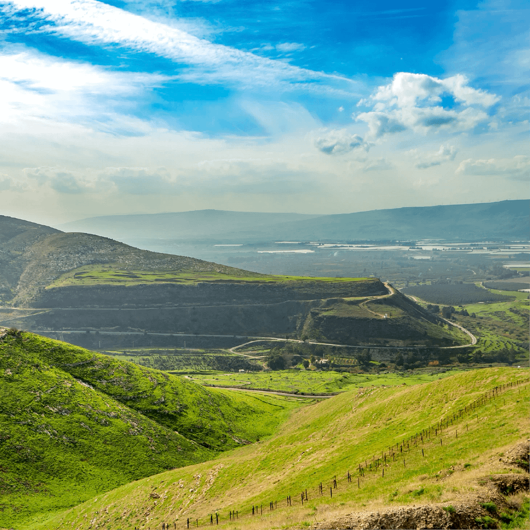
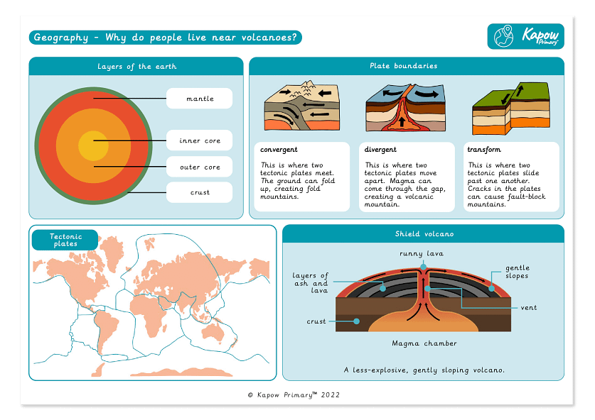
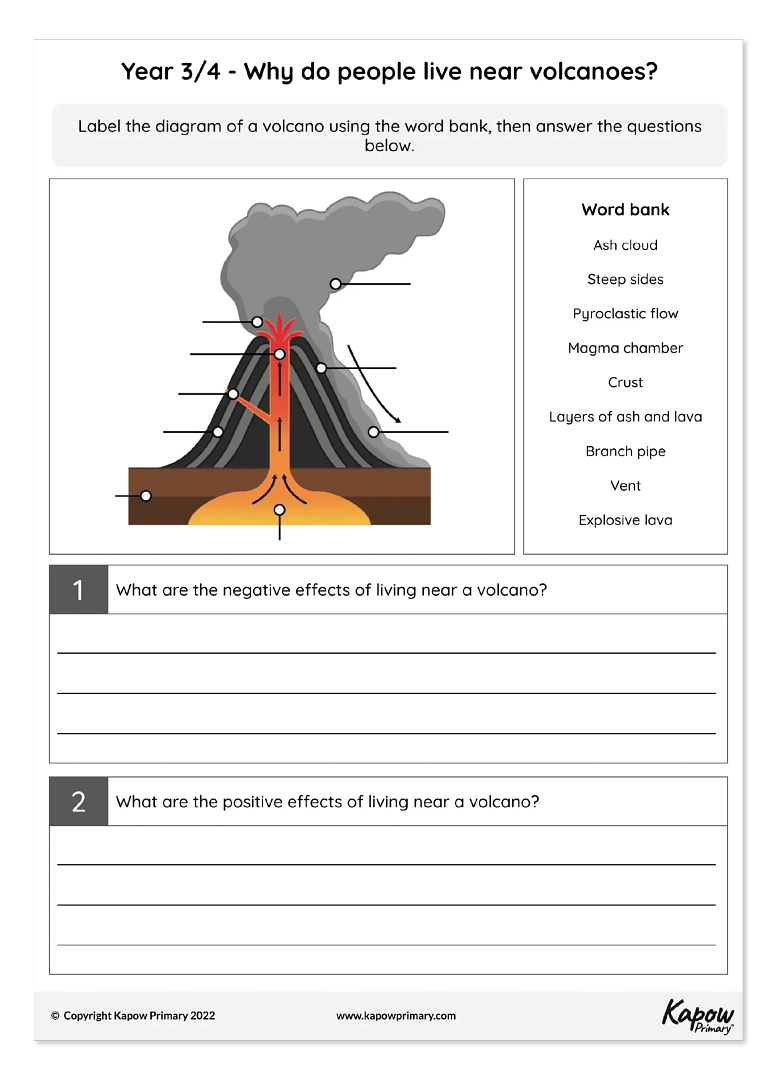
In Key stage 1, the curriculum is designed to help pupils develop a clear understanding of scale and place. This is achieved by first exploring their immediate surroundings, then examining contexts at the national level and finally looking at global contexts that are likely to be unfamiliar to them.
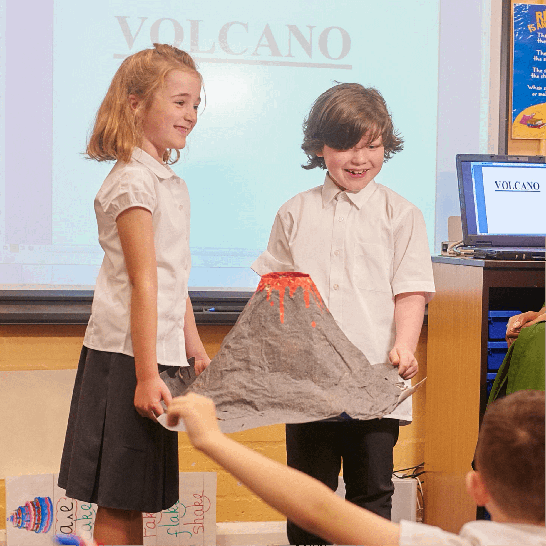
In Key stage 2, guided by the National curriculum, units are organised to reflect a regional approach. For example, the Amazonian region, a volcanic area in Southern Italy, the Alps, the Great Barrier Reef and a desert region. Case studies are selected not only to adhere to the National curriculum guidance but also to ensure children gain experience learning about a location on each continent by the end of primary school.